Big Sur: Recs
About
Big Sur is a stretch of Northern Californian coastline made up of 4 state parks. It starts south of Carmel and ends north of San Simeon (~70 miles). I took big group trips to Big Sur in April 2018 and 2019 for the Big Sur Marathon.
Best months to visit Big Sur are May-Oct as these are hottest and driest months. If you want to avoid crowds, visit in the Fall/Winter instead.
Sights/Activities
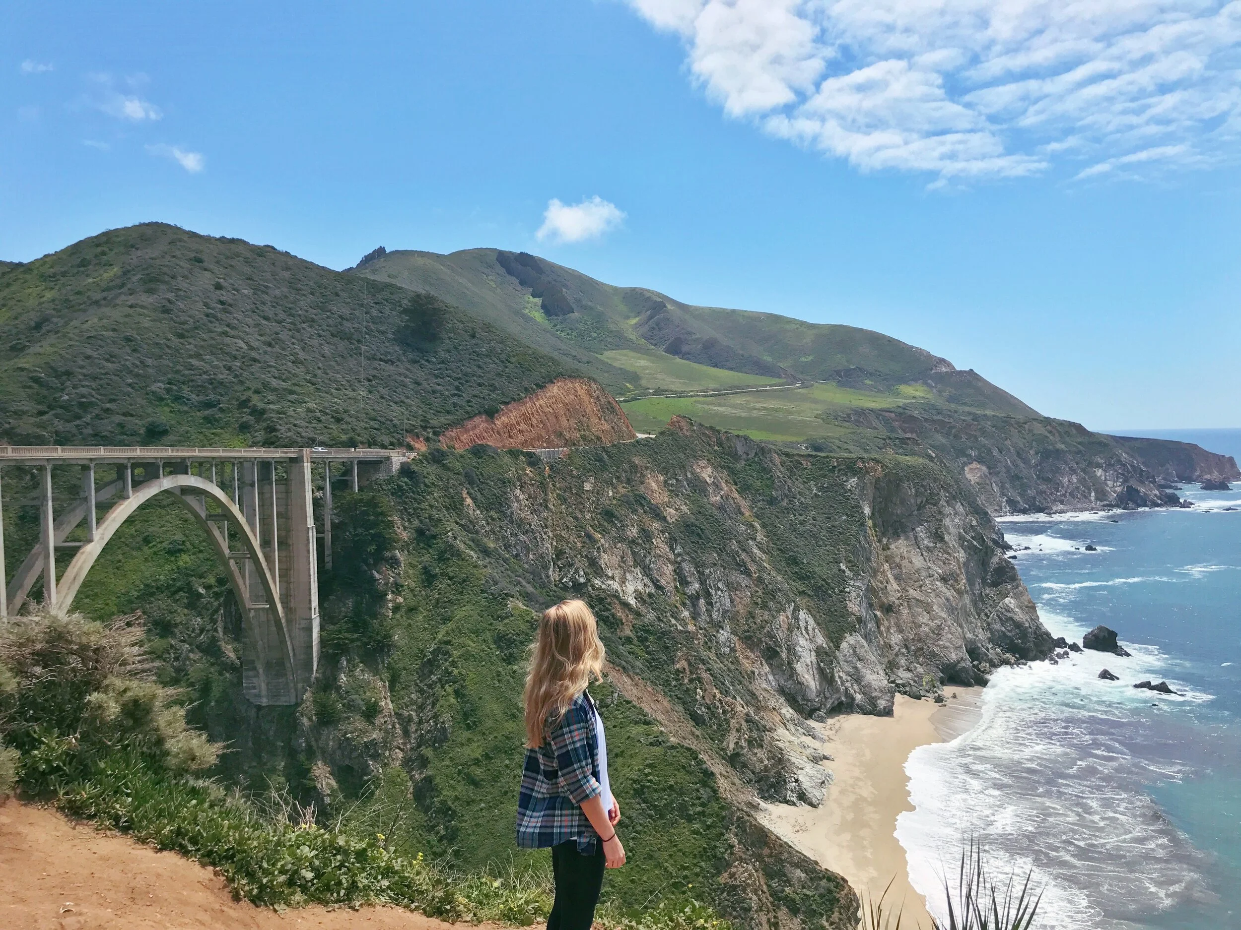
Bixby Bridge: Probably the most photographed spot in Big Sur. There will be many cars stopped on the side of the road and you’ll have to wait your turn to take a pic. If the crowd on the northern end of the bridge is too much, drive across the bridge and stop at one of the pull-outs on the southern end (still a cool view).
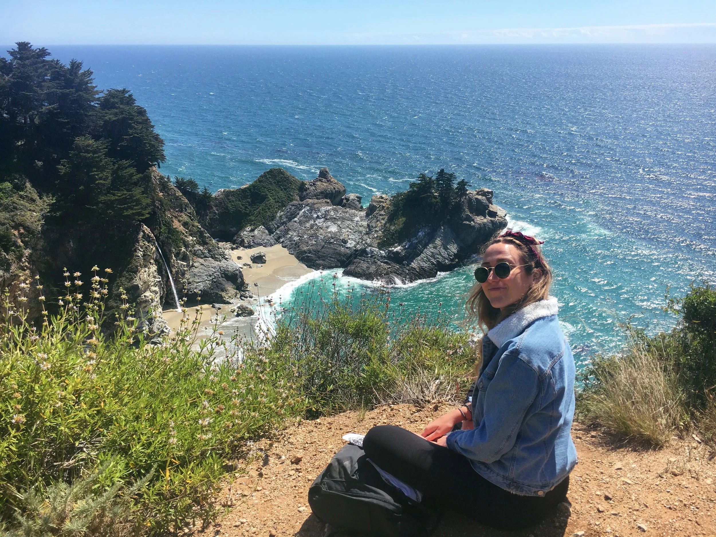
McWay Falls: Probably the second most photographed spot but worth it. The waterfall lands on the beach. There is a large parking lot (pay to park) and a maintained path to walk under highway 1 to view the falls. Hiking down is prohibited. Note if you hike up and along the highway there is another great lookout spot (pictured above) with far less people.
Esalen Hot Springs: This is a cliffside retreat center/educational institute. They have hotspring baths overlooking the pacific ocean that are open to the public after 1am. Spots are limited and sell out within minutes each night. We did this and it was quite the experience (fyi they’re communal pools and everyone bathes naked).
Tassajara Hot Springs: Buddhist center whose facilities including bathing creeks and hot springs that are open to the public from April-Sept.
Henry Miller Memorial Library: Cute non-profit bookstore and arts center nestled in the forrest in big sur. It’s a fun lil stop near Nepenthe.
Beaches/Food
Pfiffer Beach: Best known for its keyhole rock structure and purple sand, Pfiffer beach is one of the most popular in Big Sur, so if you want to visit you must go early before the parking lot fills up.
Andrew Molera State Park Beach: This is the other easily accessible beach within Big Sur. Its large, rugged and often windy. There is a large parking lot (that rarely fills up unlike Pfiffer) and ~1 mile flat sandy path that leads you to the beach.
Nepenthe: Popular cliffside restaurant in Big Sur with amazing views of the pacific ocean and well known for their burger (call ahead for a reservation if possible otherwise be prepared to wait).
Cafe Kevah: Sister restaurant below Nepenthe. Also has great views without as much of a wait.
Big Sur Bakery: Super cute and rustic, great pastries. If you plan to sit down for a real make a reservation ahead of time as its v small.
Big Sur Deli: Great spot to grab sandwhiches for a hike/beach picnic. Bigsur taphouse is located right above the deli and has a great outdoor seating area.
Hikes
IMO the following hikes had the best coastal views:
Pacific Valley Bluff Trail: .7 miles out and back most scenic short coastal trail in our estimation, and one you won't want to miss even if you only have time for a few stops along the highway. (30 min south of McWay falls).
Sand Dollar Beach Trail: .7 miles. largest crescent of sandy beach in Big Sur, set below the dramatic Pacific Valley cliffs. (30 min south of McWay falls).
Parington Cove Trail: 1 mile quick and steep hike takes you down through a tree-lined canyon to a scenic rocky beach and through a tunnel to Partington Cove. (4 min North of McWay Falls).
Jade Cove Trail: 1.5 miles bluff trail with wide-open views of the coast and several rocky coves. The Jade Cove Trail is a simple flat path that loops out to the coast with a steep but short path down to the water where you can hunt for jade. (30 min south of McWay falls).
Soberanes Canyon Trail: 5.4 mile beautiful loop near Carmel, steep with great views at the top.
Ewoldsen Trail: 5.8 mile loop near McWay falls, with everything from forrest to sweeping ocean views. Currently closed due to fallen trees blocking the trail but many hikers are still doing it.
Andrew Molera Loop: 8.8 mile loop favorite bluff walk above the shore, and also tops out with southern views into the populated Big Sur region. (26 min north of McWay falls)
Accomodation
If you’re not camping, staying in a hotel or Airnb in Big Sur is expensive. The Carmel Highlands are a great alternative (and where we usually stay). That said, ranging from backcountry camping to high end resorts, these are the top options:
Pfiffer Julia Burns State Park has two of the most beautiful campgrounds in California overlook ing McWay falls. Since there are only two they book within seconds and you have to book 6-months in advance. Booking info here. Reservations made here.
Santa Lucia Creek/Last Chance Falls in the Vetana wilderness is one of the most beautiful backcountry waterfalls in Big Sur (however the falls are seasonal and only flowing after hefty rainfall). Overnight camping options are in the Arroyo Seco campground or the Last Chance Falls campground. Trail map to last chance falls here.
Treebones Resort: This is fairly well known glamping option where you can stay in cliffside yurts, or camp in the insta famous human nest.
Ventana Resort: Offers both rustic luxury rooms and glamping options.
Post Ranch Inn: Cliffside bougie resort with private hot tubs and heated communal infinity pool overlooking the pacific ocean. Truly insane.
Carmel
Whenever we head to Big Sur we spend a lot of time in Carmel-By-The-Sea. Super cute town thats deff worth stopping or staying in.
Point Lobos State Natural Reserve: Beautiful state park between Big Sur and Carmel. There are plenty of easy trails and you can often see seals and other marine life. Would recommend doing the .8 mile China Beach hike to see turquoise blue waters.
Gerrapata Bluff Trail: Easy out and back trail within Garrapata State Park along the coast.
Carmel River State Beach: Mile long white sand beach, can park in the parking lot or nearby streets. The tide can be dangerous here however so be cautious of swimming.
Carmel Belle: Cute casual spot where we had breakfast, theres an indoor fire place and lots of seating. Really great food (juice bar, avo toast, all the basics).
Carmel Plaza: Wine tasting rooms, “the cheese shop” for great cheese, “yeast of yeden” brewery.
Carmel Highlands Hyatt Hotel: Eat at California Market at Pacific’s Edge overlooking the ocean or grab a drink at the sunset lounge.
PaciFic Grove/Pebble Beach
Pacific Grove and Pebble Beach are cute coastal cities within Monterey country:
Asilomar State Beach: Beautiful 1 mile strip of wild beach/rocky coves with a wooden walking/biking trail.
17-Mile Drive: Scenic drive in private pebble beach ($10.50 per car to enter) map here. Best stops along the way are Spanish Bay, China Rock, Seal Rock, Cypress point lookout, Crocker grove, The lone cypress and Lookout at pebble beach.
The Bench: Outdoor firepits looking over the lagoon for drinks/lunch along the pebble beach golf course.
Spanish Bay: Lobby Lounge for drinks/fire pits on the coastline.
Fort Orde Dunes State Park: Big Dunes and small strip of beach near Monterrey. Easy walking trails.
Lovers Point Marine Reserve: They film big little lies here. When we visited it was extremely crowded and the seagulls/squirrels are so used to people that they stole our food (no joke) kinda scary.
Pavel's Backerei: Giant delicious pastries, cash only.
Poppy Hall: Amazing sit down dining, owned by Big Sur Bakery.


